-
07542758948
Home
Home
OgImage:
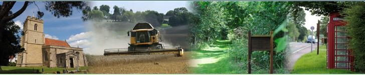
Buckland and Chipping Parish Council
What Is Buckland and Chipping Parish Council?
It is one of the 10,000 community, Parish and town councils in England and Wales; they are corporate bodies and local authorities. It has a powerful voice to represent local people.
The current chairman of the Council is Jeffrey Kenyon. The councillors are: Penny Baxter-Newman and Helen Dauris. There are three casual vacancies available, if you are interested in joining the Parish Council please contact the Clerk.
Councillors are elected by the public at local government elections, normally held on the first Thursday in May every four years. The last election was in 2023. If a vacancy occurs during the four-year term, it may be filled by co-option or through a by-election if there are more candidates than vacant seats and it is requested by 10 parish electors.
Working as a Parish Councillor is done voluntarily. There is no salary involved but you have the chance to influence decisions to improve the services for your local area.
Parish councils are the part of local government closest to the people. They serve the smallest area and are responsible for the most local of matters. Very importantly, these councils can "precept" – raising money collected with the local Council tax each year to improve facilities and services for local people in the area of the Parish Council.
Parish Councils in England have a number of basic responsibilities in making the lives of local communities more comfortable, many of which are often taken for granted. Essentially these powers fall within three main categories: representing the whole electorate within the Parish; delivering services to meet local needs, and striving to improve the quality-of-life in the Parish.
Parish Councils, also comment on planning applications, they are statutory consultees and can be represented at public enquiries. Parish councils may soon be granted more powers.
Buckland and Chipping Parish Council were responsible for providing the bus shelters in the villages. They have provided the information boards, the seats and picnic tables in various parts of the villages. They have also taken responsibility for cutting the grass in the churchyard. They are responsible for areas of common land in the parish.
The Parish Council works closely with the County authorities to make sure that the roads and footpaths are maintained properly, although it has no direct responsibility for them.
Latest Parish News
Agricultural and Countryside Service
St Andrew's Church, Buckland
10
February 2025

Rev Mark Bridgen, our new vicar, is now organising agricultural and countryside services across the benefice. The next service will be held in Buckland at 10am on Monday 10th February. This will be a Good Shepherd/ Lambing service and all are welcome.

Buckland & Chipping Parish
°C
mph
FRI
 °
°
°
°
SAT
°
°
SUN
°
°
MON
°
°
TUE
°
°